


My guide stopped, motioned for me to get off the bike, and showed me the secret passage.
“No fucking way!” I said. He spoke no English. He understood perfectly.
Let me back up...
Riding south, I saw farmland as far as the eye could see. Raised on a farm, I recognized the dark, rich soil, tilled and ready for planting. This is the Sinaloa winter-vegetable belt, which supplies a huge share of the tomatoes, peppers, and cucumbers shipped to the U.S.
Jornaleros, migrant farmworkers, many of them indigenous families from Guerrero and Oaxaca, work the fields and live in company campos for the growing season.
Celestino Gasca Villaseñor was a Mexican Revolution-era general and notable labor politician. As an old man, he led a disastrous farmers’ uprising. Several agrarian ejidos bear his name. It’s officially “Gazca,” with a z. A town named in his honor, but they got the spelling wrong. Mexican bureaucracy at its finest.
They founded the ejido on May 9, 1975. Among the three founding families living under the trees, without water or electricity, were Inés Niebla and Fidencio Sánchez. They still live there.
So, why am I here? Certainly no family connections; I was just here for my first chance to spend time in a Pacific coast fishing village. I had been hurricane-ed out of my earlier picks.
I had booked my room the previous evening. I found a place where I could be on the beach and still have a good workspace to write articles, edit photos and launder some well-aged clothing.
Local writers praise Celestino’s famous ostiones de piedra (rock oysters), and Mexicans throughout the country rave about the great Sinaloan shrimp. So before checking into my hotel, I researched these claims and found La Fortaleza, a beachside seafood restaurant
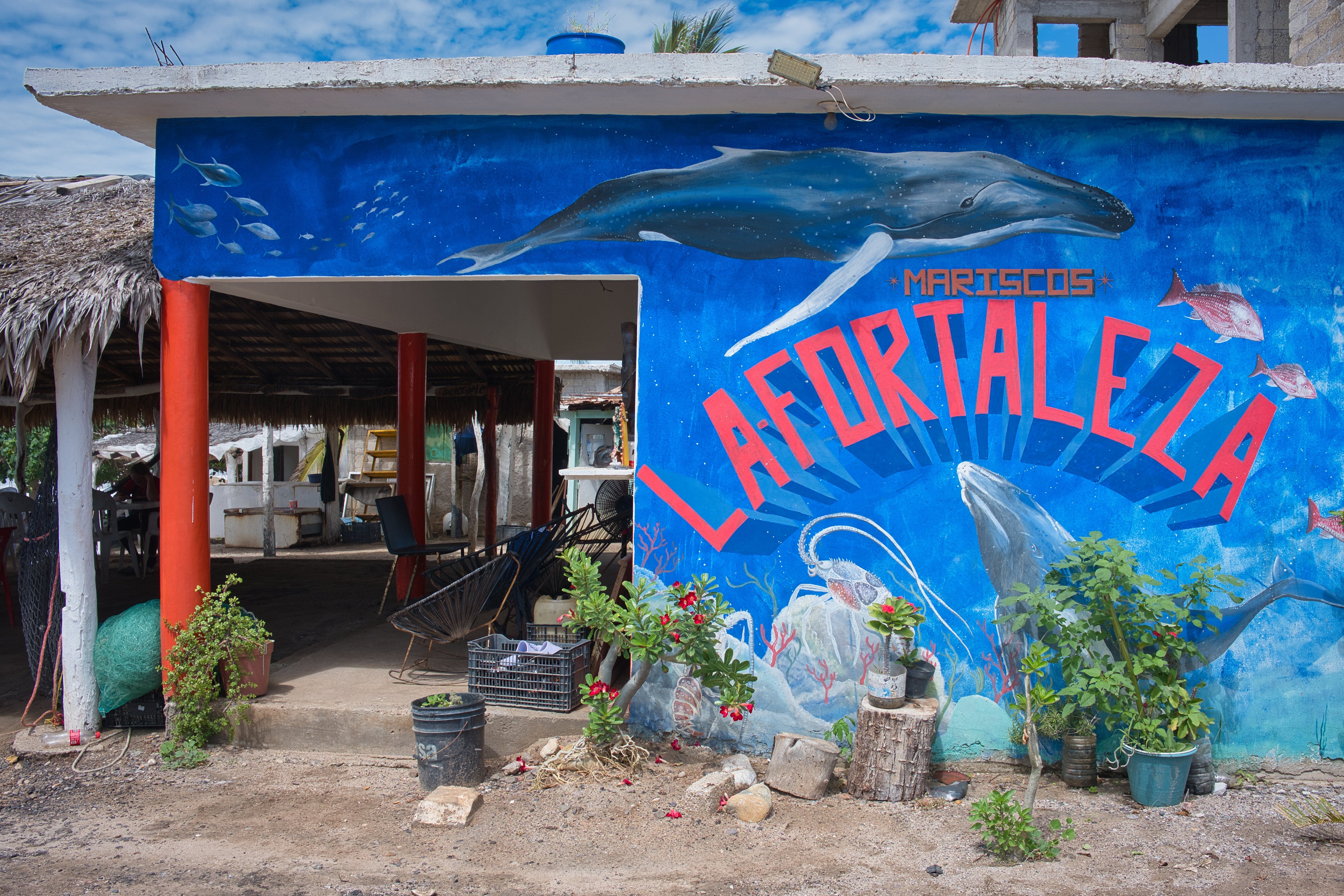
.A family affair: the teenage daughter sheepishly offers me the menu, her younger sister checks me out while lounging in a hammock, the grandmother sets out the flatware and condiments, Mom does the cooking, and Dad goes to the local tienda to buy the beer I ordered. No oysters on the menu today. Instead, I ordered shrimp tacos and aguachile (raw shrimp bathed in “chile water” – it smokes!). Sinaloa shrimp could be the best prawns in the world. As I ate, Dad resumed repairing his fishing nets.
The heat was building again, and I needed a break. So off to my perfect new accommodations. Nobody told me before I rode off that three consecutive nights of torrential rain had fallen, courtesy of the outer band of Hurricane Rachel. Here I was, naively assuming my hurricane days were over.
The hotel was about four kilometers down the road. Four kilometers of deep ponds flooding the greasy road.
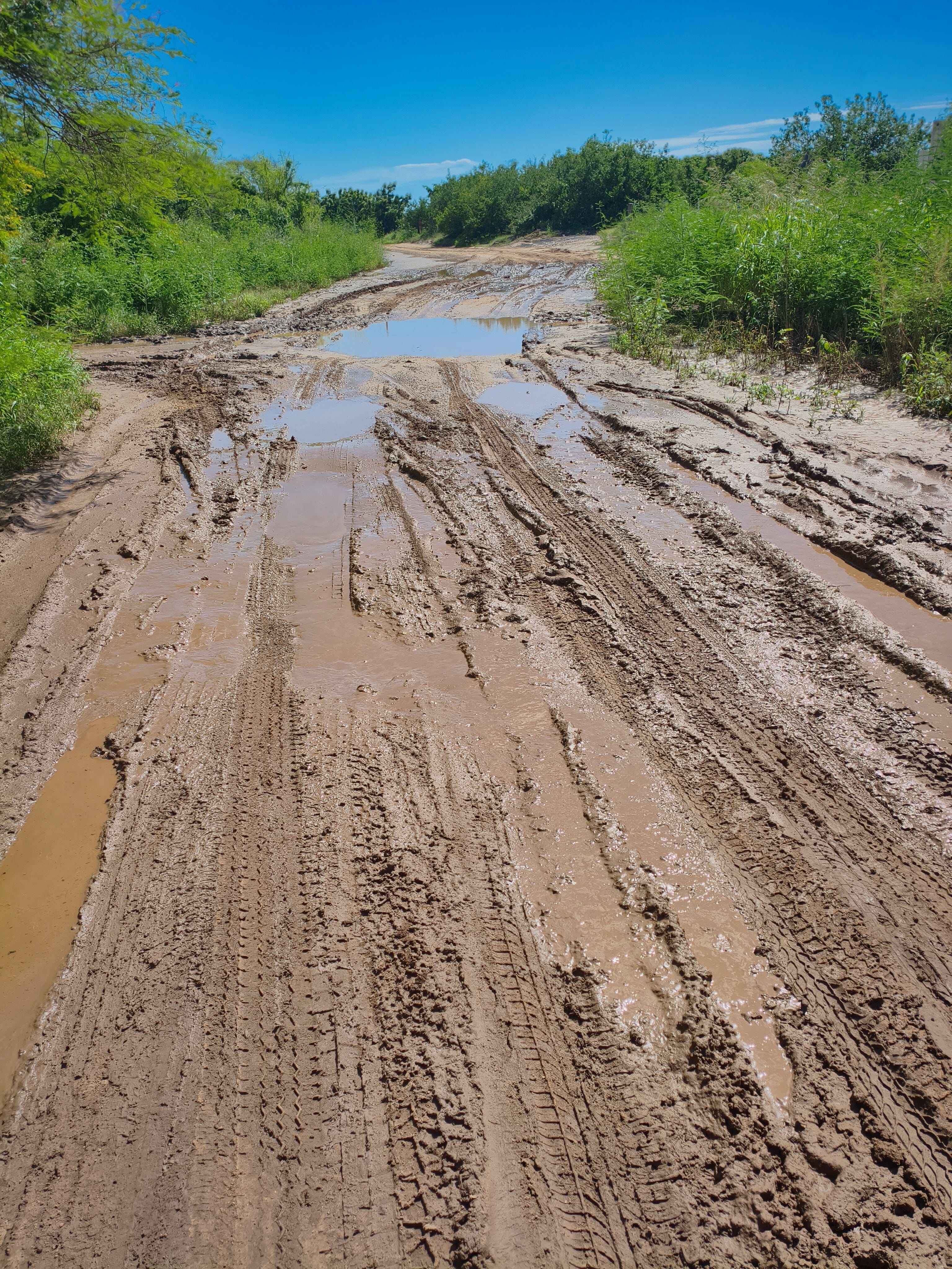
I made it through three ponds, but it was looking progressively worse.
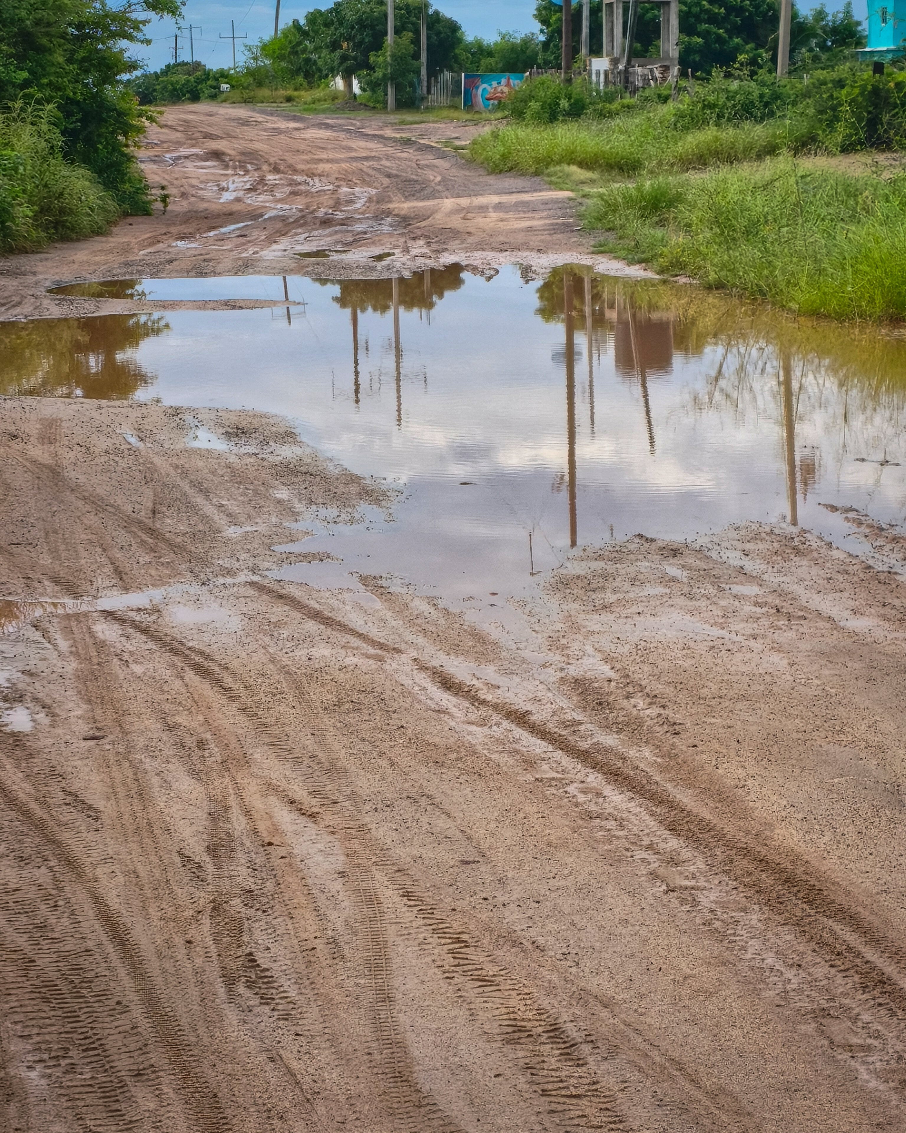
I WhatsApp’ed the hotel and said that I couldn’t make it. The lady insisted that I could. I stood my ground. So she said she would send out a young man on a moto to show me a back way in.
He arrived and asked me to follow him closely. Thirty minutes later, we hit the freeway, then a gnarly dirt road back toward the beach. We rounded a corner, and I was surprised by a railway bridge. And a small lake stretched out in the distance. My guide motioned for me to get off the bike and showed me the secret passage. They had built a six-inch-wide detour along the embankment using small stones. I nervously laughed and exclaimed, “No fucking way!” He spoke no English but understood perfectly.
I told him we could trade bikes: I could ride his small, light dirt bike, and he could take my KTM. In perfect Español, he said, “No fucking way!”
So he called the hotel boss, explained the problem, and we agreed to abandon this crazy plan. We split. I reached the cuota (freeway) and noticed the “Low Fuel” indicator had come on. I could have easily reached the closest gas station by heading back north, but I discovered there was no way to cross the freeway to go north. Instead, I had to turn south and ride to find a retorno (U-turn location). Fortunately, a gas station was near the retorno. Unfortunately, that was another 25 kilometers away.
All in all, 90 minutes to get back to the village. I bought a beer, pulled up Booking, and had a replacement hotel on the beach in no time.
This one with no seasonal water features.
More Photos
Celestino Gazca Villaseñor annual rainfall: 600–800 mm (24–31 inches)
Altitude: 23 meters (75 feet)
Cumulative distance ridden: 3,160 kilometers
Day 16: El Fuerte to Mocorito

The road signs outside Mocorito carry the town’s name and a QR code. I guess you stop in the middle of the road and scan it for tourist information?